Guide to 18 Largest Cities in Ecuador (Population, Elevation, Attractions…)
As you plan your trip (or relocation) to Ecuador, it’s good to know about the major cities. In this post, you’ll learn about the largest cities in Ecuador, including details like their population, elevation, attractions, locations and more. I’ll share a ton of additional resources to help you learn about each of these areas.
Guide to Cities in Ecuador
Ecuador is a diverse and relatively small country. To help you get a clear picture of the major cities and areas, we put together this guide.
First, this list gives an overview of major cities in Ecuador, organized by largest to smallest (according to population).
| City | Province | Population | |
|---|---|---|---|
| 1 | Guayaquil | Guayas | 2,278,691 |
| 2 | Quito | Pichincha | 1,607,734 |
| 3 | Cuenca | Azuay | 329,928 |
| 4 | Santo Domingo | Santo Domingo | 270,875 |
| 5 | Machala | El Oro | 231,260 |
| 6 | Durán | Guayas | 230,839 |
| 7 | Manta | Manabí | 217,553 |
| 8 | Portoviejo | Manabí | 206,682 |
| 9 | Ibarra | Imbabura | 181,175 |
| 10 | Quevedo | Los Ríos | 173,585 |
| 11 | Loja | Loja | 170,280 |
| 12 | Ambato | Tungurahua | 165,185 |
| 13 | Esmeraldas | Esmeraldas | 161,868 |
| 14 | Riobamba | Chimborazo | 156,723 |
| 15 | Milagro | Guayas | 133,508 |
| 16 | Latacunga | Cotopaxi | 98,355 |
| 17 | La Libertad | Santa Elena | 95,942 |
| 18 | Babahoyo | Los Ríos | 90,191 |
These cities are spread across the country, in many of Ecuador’s 24 provinces.
Now with the overview out of the way, let’s dive into the details on the 8 largest cities in Ecuador. These all have more than 200,000 inhabitants.
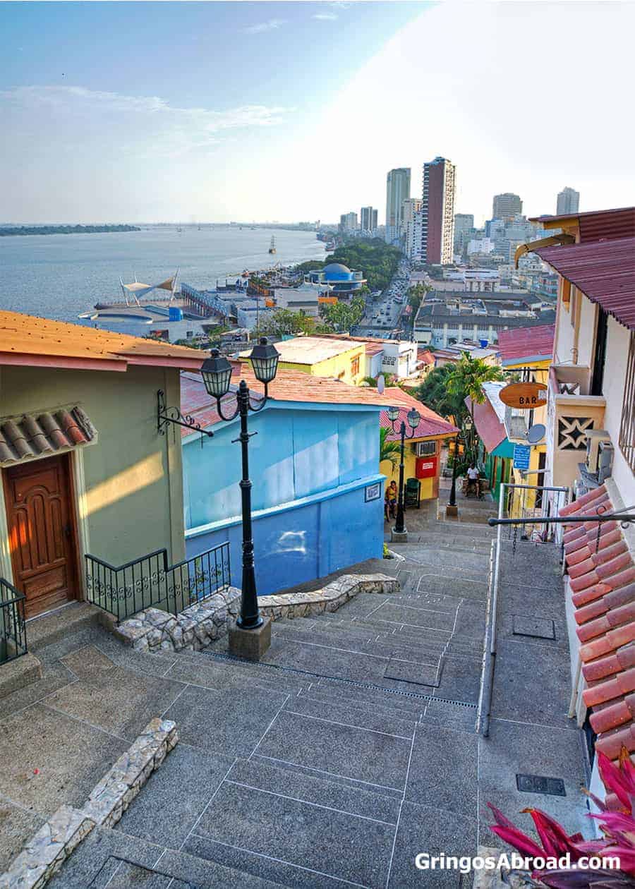
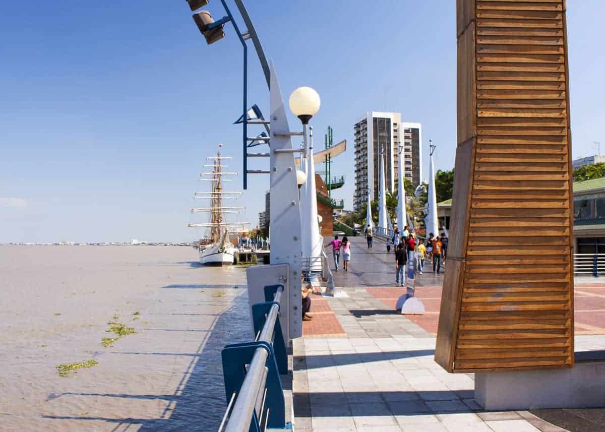
1. Guayaquil
Guayaquil is a beautiful coastal city and is Ecuador’s most populated city. It is visited by many international tourists – if even for a short time as they pass through its international airport.
Guayaquil is the commercial center for Ecuador. It is home to the country’s most important port (Port of Guayaquil) and most of Ecuador’s import/export goods pass through here.
Here’s an overview of the city:
- Population: 2,278,691
- Province: Guayas
- Demonym(s): Guayaquilean. In Spanish, Guayaquileño/a.
- Elevation: 13 feet (4 meters)
- Land area: 133 sq mi (344 km2)
- Postal code: 090101 to 090158
- Time zone: UTC-5 (ECT)
- Climate: (Aw) Tropical savanna climate (tropical wet and dry climate)
- Weather: Generally hot and humid. Rainy season is January through April. See our full guide to Guayaquil weather.
- Attractions: Iguana Park (Parque Seminario), Malecon 2000, Guayaquil Historical Park, Isla Santay, and Zoo el Pantanal.
Guayaquil was settled on July 25, 1535 and gained its independence on October 9, 1820.
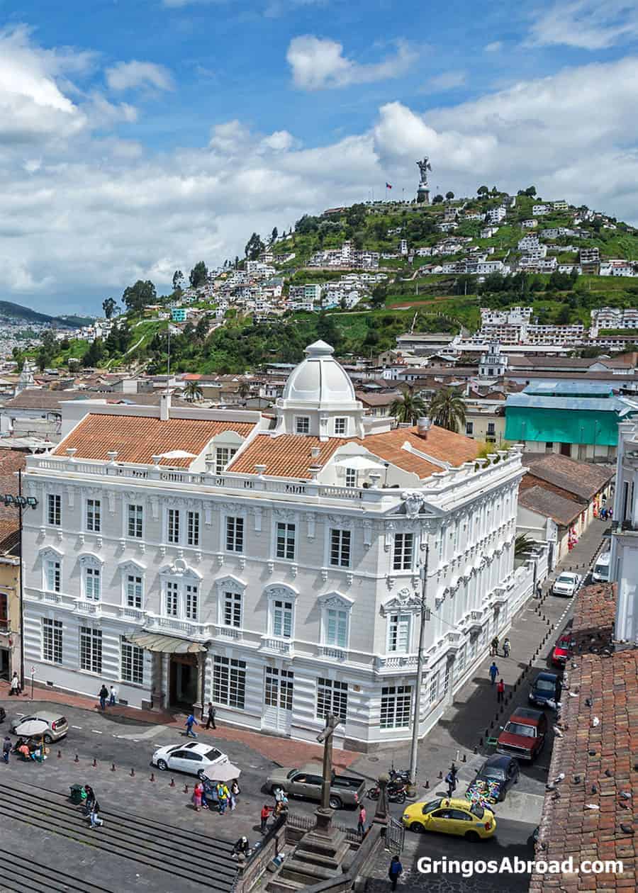
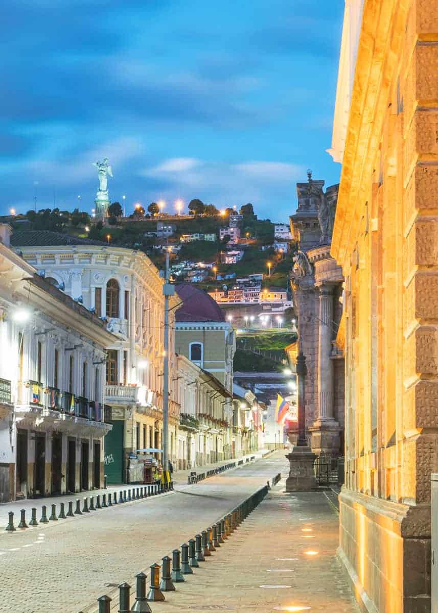
2. Quito
Quito is Ecuador’s political capital and is located high in the Andes mountains. In fact, it is the highest constitutional capital in the world. Here are more Quito facts. It is Ecuador’s second-largest city by population.
It is home to Quito International Airport and is one of two primary entry points for foreign tourists.
Here’s an overview of the city:
- Population: 1,607,734
- Province: Pichincha
- Demonym(s): Quitonian. In Spanish, Quiteño/a
- Elevation: 9,350 feet (2,850 meters). Here’s more about Quito’s elevation and latitude.
- Land area: 144 sq mi (372 km2)
- Postal code: EC1701
- Time zone: UTC-5 (ECT)
- Climate: (Cfb) Oceanic climate (marine climate or temperate oceanic climate)
- Weather: Generally cool with fairly consistent rainfall. Rainy season is primarily February through May. See our full guide to Quito weather.
- Attractions: Quito’s Old Town, Mitad del Mundo, Teleferiqo (cable car), and Mariscal Artisan Market. See more things to do here.
Quito was founded on December 6, 1534.
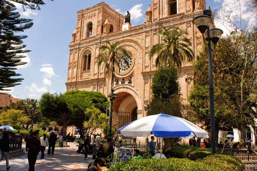
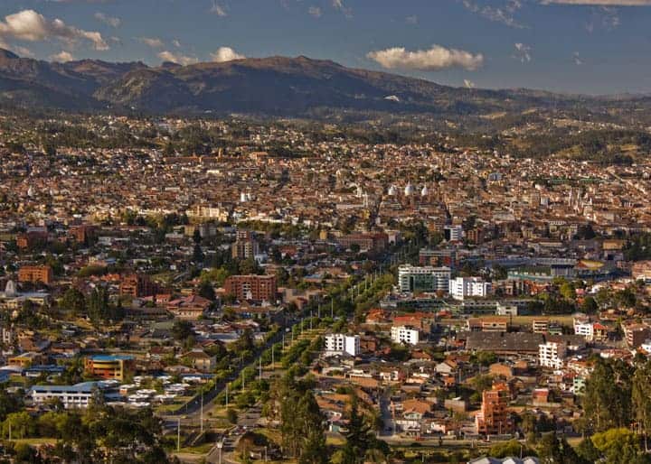
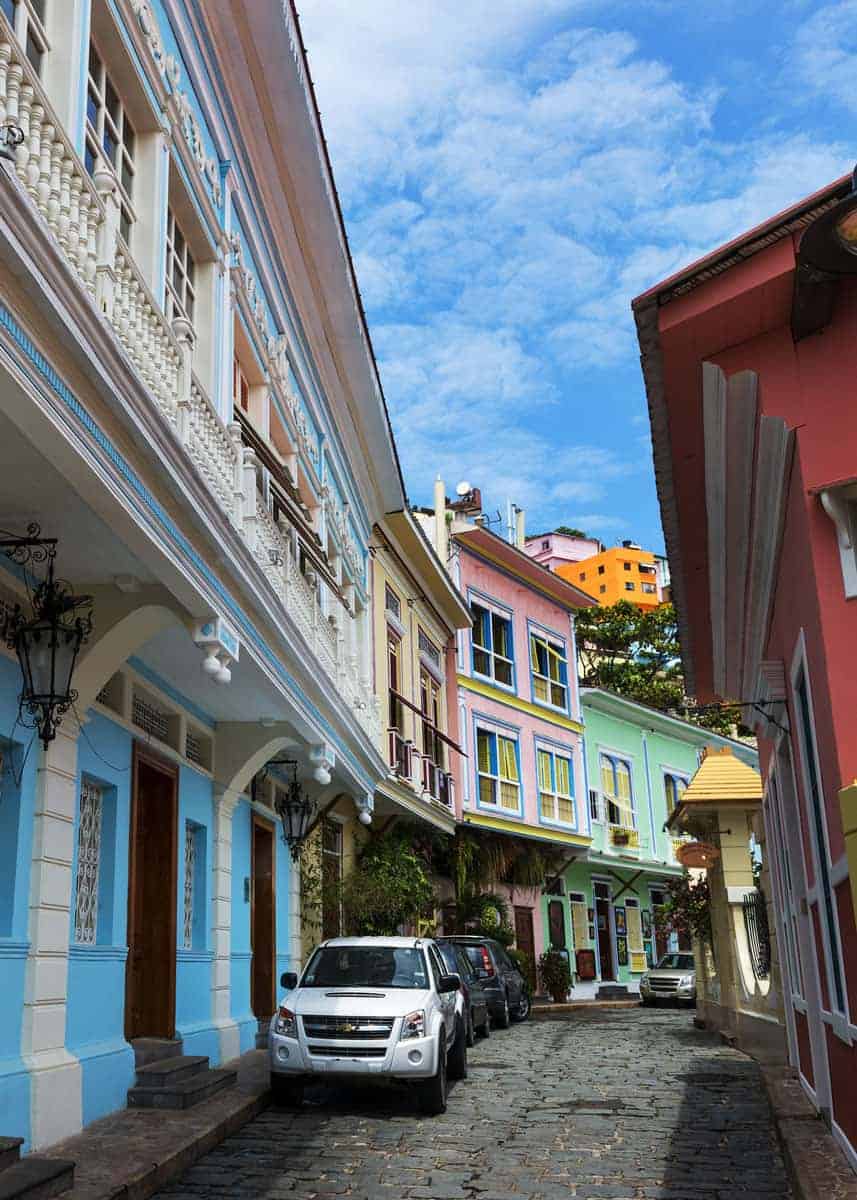
3. Cuenca
Cuenca is a small, clean city located in the southern portion of Ecuador. It is a popular destination for both expats and travelers.
Cuenca is an especially walkable city. Here’s a half day, kid friendly walking tour that is one of our favorites.
Here’s an overview of the city:
- Population: 329,928
- Province: Azuay
- Demonym(s): Cuencan. In Spanish, Cuencano/a
- Elevation: 8,400 feet (2,560 meters)
- Land area: 27 sq mi (71 km2)
- Postal code: EC010150
- Time zone: UTC-5 (ECT)
- Climate: (Cfb) Oceanic climate (marine climate or temperate oceanic climate)
- Weather: Generally cool with fairly consistent rainfall. Rainy season is primarily March through May. The climate is often described as “spring-like”. See our full guide to Cuenca weather.
- Attractions: Cajas National Park, Flower Market, Casa de la Mujer, Mirador de Turi, Parque Calderon, and See more things to do here.
Cuenca was founded on April 12, 1557. It was named after Cuenca, Spain. Cuenca has 36 parroquias (parishes).
Want to get a big picture view of Cuenca? Check out our 12-video city tour.
4. Santo Domingo
Santo Domingo is a city (and province) located west of Quito, in northern Ecuador. It is in the Andean foothills, and is an important stopping point between Quito and the Pacific ocean.
Here’s an overview of the city:
- Population: 270,875
- Province: Santo Domingo
- Demonym(s): In Spanish, Santodomingueño/a
- Elevation: 2,051 ft (625 m)
- Land area: 422 sq mi (1,093 km2)
- Postal code: EC230102
- Time zone: UTC-5 (ECT)
- Climate: (Am) Tropical monsoon climate (tropical wet climate).
- Weather: Generally hot and humid all year. Rainy season is primarily January through May.
- Attractions: Jardín Botánico La Carolina, Tinalandia, Tsáchila Communities, and Bosque Protector Río Guajalito scientific station.
Santo Domingo was founded on May 29, 1861.
5. Machala
Machala is known as the Banana Capital of the World. It is home to Ecuador’s second-largest port, after Guayaquil.
The city is located on the Pacific coast, south of Guayaquil and southwest of Cuenca.
Here’s an overview of the city:
- Population: 231,260
- Province: El Oro
- Demonym(s): In Spanish, Machaleño/a
- Elevation: 20 ft (6 m)
- Land area: 80 sq mi (207 km2)
- Postal code: EC070150
- Time zone: UTC-5 (ECT)
- Climate: (BSh) Semi-arid climate (or steppe climate)
- Weather: Generally hot and humid all year. Rainy season is January through April, although it doesn’t rain much.
- Attractions: Puyango Petrified Forest, Jambeli Island, Piñas village, Parque Lineal, and Banana Monument.
Machala was founded in 1573.
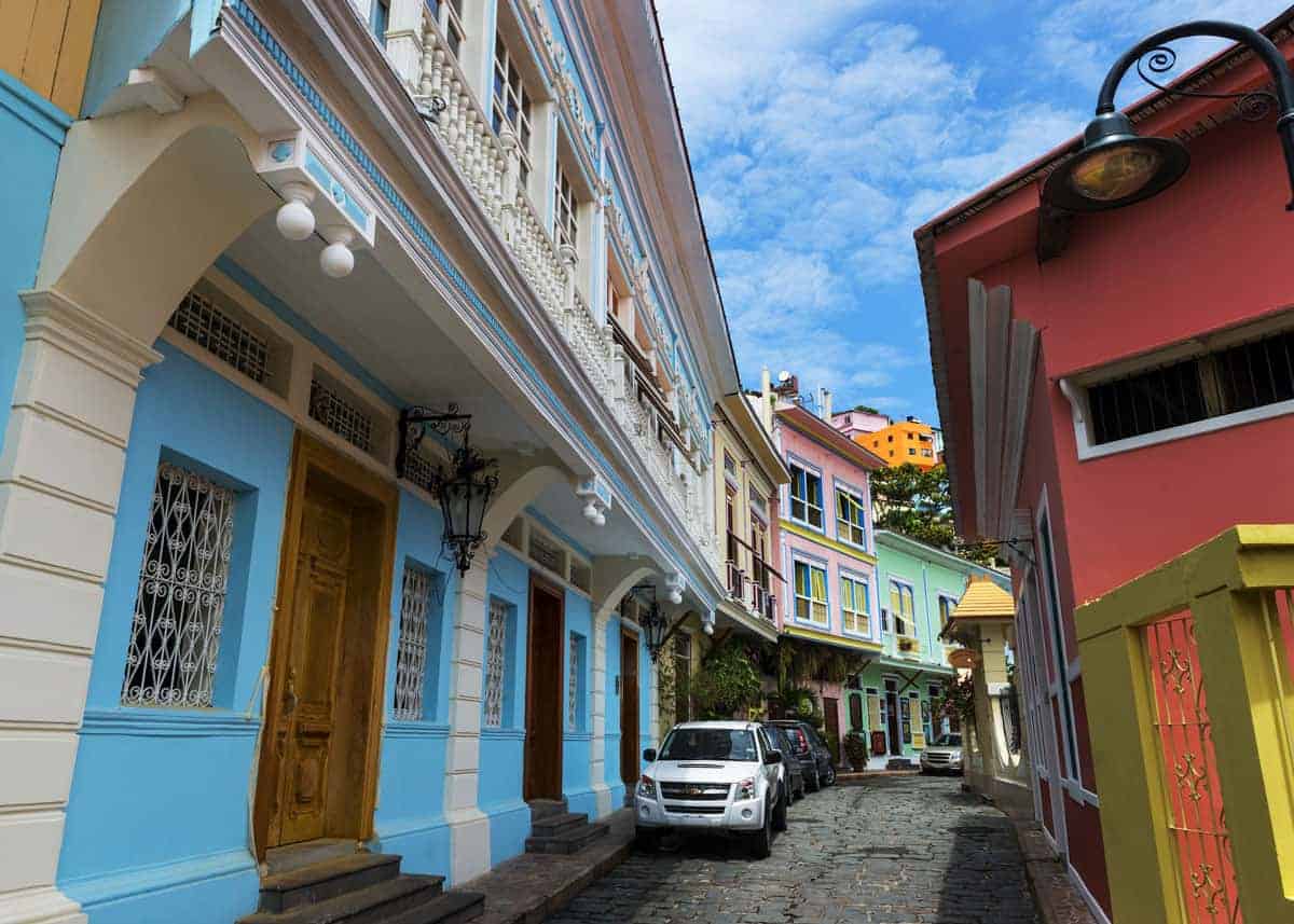
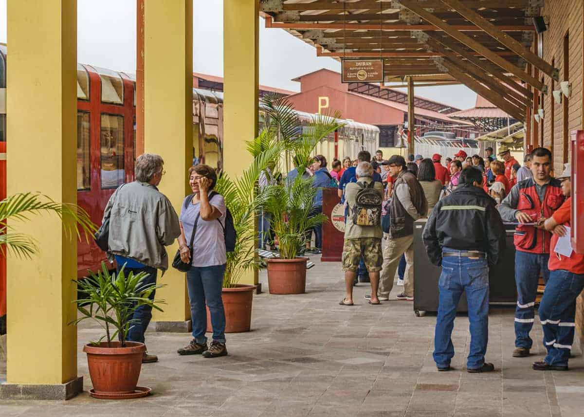
6. Durán (Eloy Alfaro)
Duran is a small city on the east banks of Rio Guayas. On the west bank is the much larger city of Guayaquil.
Duran is known as a dormitory town, because many residents travel to other cities and regions for work, returning at night to sleep there.
The legal structure of the city/canton is a little confusing. While the city is known as Duran, it is also known as Eloy Alfaro. Officially, Duran is the name of the canton (county) with Eloy Alfaro as its capital.
Here’s an overview of the city:
- Population: 230,839
- Province: Guayas
- Demonym(s): In Spanish, Duraneño/a
- Elevation: 13 ft (4 m)
- Land area: 22 sq mi (59 km2)
- Postal code: EC090701
- Time zone: UTC-5 (ECT)
- Climate: (Aw) Tropical savanna climate (tropical wet and dry climate)
- Weather: Generally hot and humid. Rainy season is January through April. See our full guide to Guayaquil weather.
- Attractions: Santay Island, Parque Lago, Churute Mangroves Ecological Reserve. Within a short drive, you can visit many beaches. And the city of Guayaquil is just over the bridge.
Duran was founded on October 16, 1924, by presidential decree (Leon Febres Cordero).
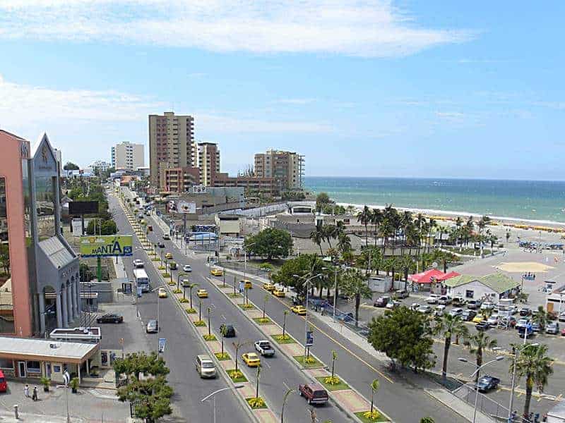
7. Manta
Manta is a city built on tuna fishing. Not coincidentally, it is also where encebollado (tuna/onion soup) originated. It has a large sea port and has the nickname “Ecuador’s First Seaport” (Primer Puerto Marítimo del Ecuador).
It is also a popular tourist destination and manufacturer of numerous consumer goods, like cleaning supplies and cooking oils.
Manta is home to some of the best beaches in Ecuador (El Murciélago, Santa Marianita, and San Lorenzo).
Here’s an overview of the city:
- Population: 217,553
- Province: Manabí
- Demonym(s): In Spanish, Mantense (according to Manta Canton entry on Wikipedia.)
- Elevation: 20 ft (6 m)
- Land area: 23 sq mi (60 km2)
- Postal code: EC1308
- Time zone: UTC-5 (ECT)
- Climate: (Bwh) Hot desert climate
- Weather: Hot all year long with little variance. Rainy season is January through April.
- Attractions: Kitesurfers and surfers come for the excellent wind conditions and powerful waves. Montecristi is nearby, the original home of the Panama hat. Less adventurous visitors like to stroll Malecón Escénico (in front of Playa Murciélago). Other attractions include Pacoche Wildlife Refuge and Museo Ciudad Alfaro.
Manta was most recently founded in 1535. It was originally known as Jocay (meaning Golden Doors) and was a Manta Indian capital in 1200 CE.
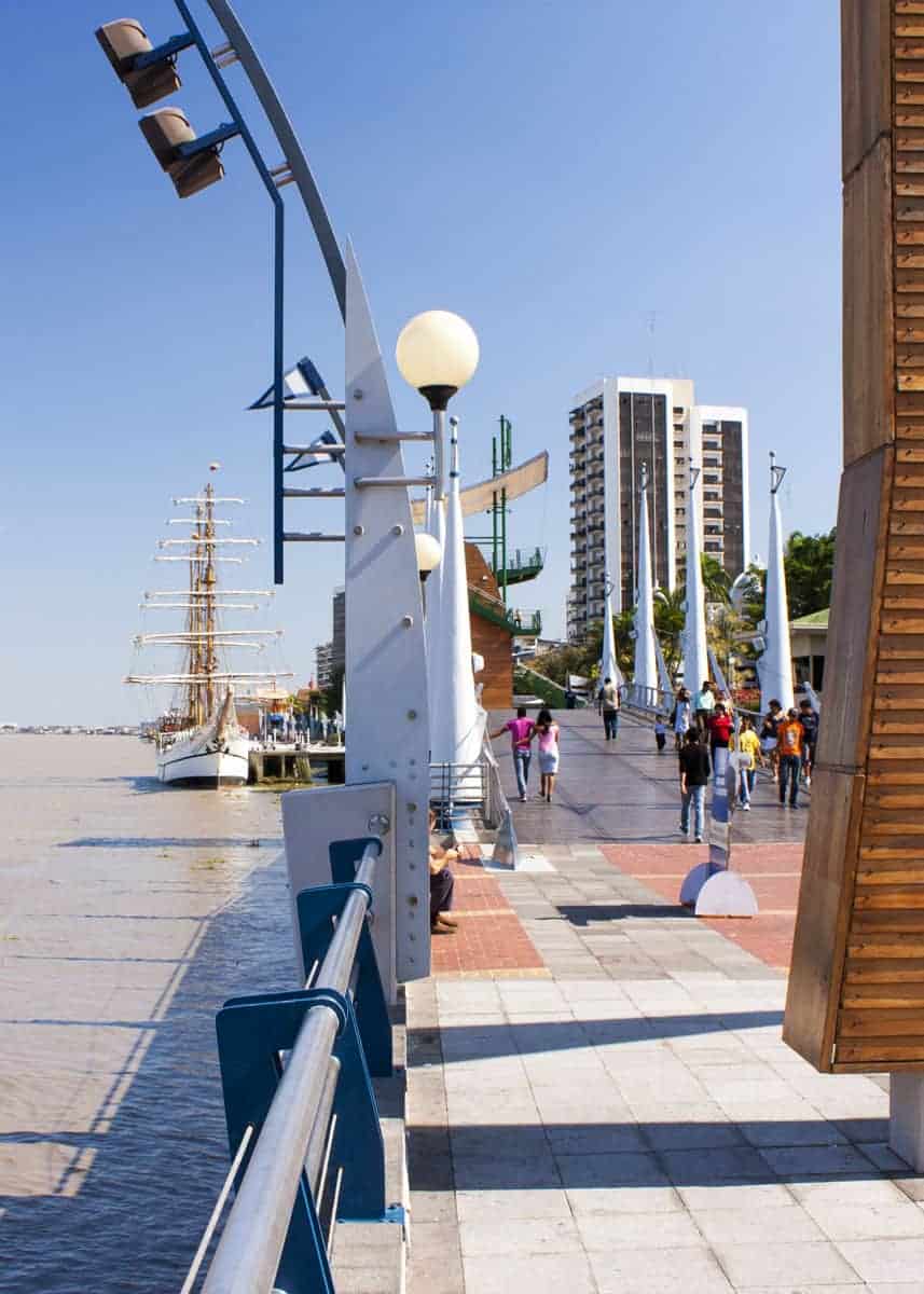
8. Portoviejo
Portoviejo is a coastal city and is the political and commercial center for the region. It is knowns as the city of the “Royal Tamarind Trees”. Locally, the fruit is known as tamarindo.
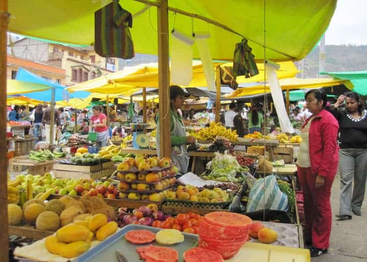
The city is located in the Portoviejo River Valley, which is an agricultural powerhouse. They grow tomatoes, peppers, coffee, bananas, mangos and many other tropical fruits. There are also fishing industry and cattle ranches in the valley.
Here’s an overview of the city:
- Population: 206,682
- Province: Manabí
- Demonym(s): In Spanish, Portovejense.
- Elevation: 174 ft (53 m)
- Land area: 161 sq mi (418 km2)
- Postal code: EC130105
- Time zone: UTC-5 (ECT)
- Climate: (Bsh) Hot semi-arid climate
- Weather: Cooler than nearby Manta, thanks to it’s elevation and being more inland. Temperatures are consistently warm year round. Rainy season is January through April.
- Attractions: Crucita Beach is world famous for paragliding. Mamey Ecological Park, Portoviejo Botanical Park, and Parque Central are all popular places for tourists. Nearby, Sosote is just a few minutes north, and is home to many tagua workshops.
Portoviejo was founded on March 12, 1535.
Common Questions about Ecuador Cities
What is the capital city of Ecuador?
Quito is the political capital of Ecuador.
What is the largest city in Ecuador?
Guayaquil is Ecuador’s largest city by population (2,278,691).
Santo Domingo de los Colorados is the biggest city in Ecuador by square footage (422 sq mi / 1,093 km2).
Which city is the primary port of Ecuador?
Guayaquil is home to the largest and most important port in Ecuador.
Other ports in Ecuador include Machala, Manta, and Esmeraldas.
What are some major cities in Ecuador?
The two primary cities in Ecuador are Guayaquil and Quito – the commercial and political capitals, respectively.
How many cities are in Ecuador?
There are 80 cities in Ecuador, with a population of 10,000 or more.
- Over 1 million: 2 (Guayaquil and Quito)
- Between 100,000 and 1 million: 13 (Cuenca, Santo Domingo, Machala, Durán, Manta, Portoviejo, Ibarra, Quevedo, Loja, Ambato, Esmeraldas, Riobamba, Milagro)
- Between 10,000 and 100,000: 65
How high is the city of Quito Ecuador?
Quito is located at 9,350 feet (2,850 meters) above sea level.
Here’s more about Quito’s latitude, elevation, and coordinates.
What is the highest capital city in the world?
Quito is the highest constitutional capital in the world.
But things aren’t always that simple. You see, Bolivia has two capital cities: La Paz is the seat of government and Sucre is the constitutional capital. This isn’t unheard of, other countries also have multiple capitals (The Netherlands, Chile, Honduras all have two capitals. South Africa even has three).
Here are the elevations of these capital cities:
- La Paz, Bolivia: 11,942 feet (3,640 meters)
- Quito, Ecuador: 9,350 feet (2,850 meters)
- Sucre, Bolivia: 9,022 feet (2,750 meters)
So measuring elevation only, the highest capital city in the world would technically be La Paz.
But if we are going to compare apple to apples, we should rank these cities by equal measure – by constitutional capitals. By this standard, Quito is the highest (constitutional) capital in the world.
Why is New York called Ecuador’s 3rd largest city?
Many taxi drivers in Ecuador lived in the States for many years. They often joke that New York is Ecuador’s third largest city, because so many Ecuadorians live there. In fact, Rafael Correa (past president of Ecuador) is reported to have joked to this effect.
How many Ecuadorians live in New York? According to the 2010 Census, there are 316,243 Ecuadorians living in the US metro area of New York-Northern New Jersey-Long Island (NY-NJ-PA MSA).
While this isn’t quite enough to top Cuenca (329,928), it does make it the 4th largest population of Ecuadorians in the world. And the largest population of Ecuadorians outside of Ecuador.
In my research, I found numerous US towns with a high percentage of people with Ecuadorian ancestry.
- Sleepy Hollow, NY (17.54%)
- Montauk, NY (4.21%)
- East Newark, NJ (19.87%)
- Ossining, NY (19.31%)
- Hightstown, NJ (14.11%)
- Union City, NJ (9.23%)
Your Turn
What cities in Ecuador are on your bucket list? Have a question? Or maybe a detail/fact to add? Let me know below!


I been living in boquete panama couple of months but kind of exp here and windy thinking of moving to Ecuador close to beach too fish